

|
Route Table |
Always Update Visible Routes |
Legend |
Mark Current Location |
| Route | Traveled by michih (miles) | |
|---|---|---|
| Visible Segments | Route Overall | |
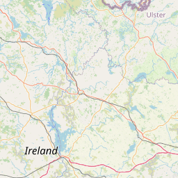
| Northern Ireland Tourist Routes (nirtr) | ||
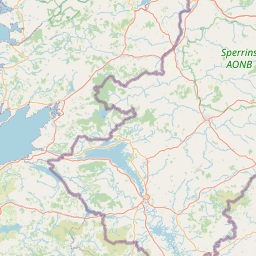
| NIR CauCR | 0.00 of 120.49 (0.0%) | 0.00 of 120.50 (0.0%) |
| NIR BroBaySR | 0.00 of 15.11 (0.0%) | 0.00 of 15.11 (0.0%) |
| NIR GleGlenSR | 0.00 of 6.46 (0.0%) | 0.00 of 6.46 (0.0%) |
| NIR GlenCloySR | 0.00 of 5.37 (0.0%) | 0.00 of 5.37 (0.0%) |
| NIR GlenBalSR | 0.00 of 11.45 (0.0%) | 0.00 of 11.45 (0.0%) |
| NIR GlenAanSR | 0.00 of 3.87 (0.0%) | 0.00 of 3.87 (0.0%) |
| NIR GlenDunSR | 0.00 of 6.73 (0.0%) | 0.00 of 6.73 (0.0%) |
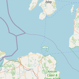
| NIR TorrHeadSR | 0.00 of 11.81 (0.0%) | 0.00 of 11.81 (0.0%) |
| NIR GlenSheSR | 0.00 of 8.98 (0.0%) | 0.00 of 8.98 (0.0%) |
| NIR GlenTaiSR | 0.00 of 4.06 (0.0%) | 0.00 of 4.06 (0.0%) |
| NIR BannValSR | 0.00 of 15.02 (0.0%) | 0.00 of 15.02 (0.0%) |
| NIR BinSR | 0.00 of 8.11 (0.0%) | 0.00 of 8.11 (0.0%) |
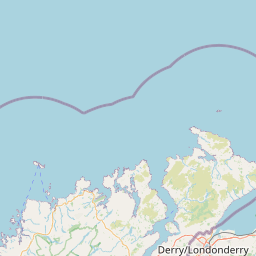
| NIR RoeValSR | 0.00 of 18.61 (0.0%) | 0.00 of 18.61 (0.0%) |
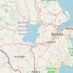
| NIR MouCRBel | 2.39 of 40.51 (5.9%) | 2.39 of 40.51 (5.9%) |
| NIR MouCR | 0.00 of 58.68 (0.0%) | 0.00 of 58.68 (0.0%) |
| NIR BalSL | 0.00 of 6.51 (0.0%) | 0.00 of 6.51 (0.0%) |
| NIR SliCroSL | 0.00 of 16.47 (0.0%) | 0.00 of 16.47 (0.0%) |
| NIR HighMouSL | 0.00 of 19.89 (0.0%) | 0.00 of 19.89 (0.0%) |
| NIR WhiSL | 0.00 of 8.84 (0.0%) | 0.00 of 8.84 (0.0%) |
| NIR RooSL | 0.00 of 17.86 (0.0%) | 0.00 of 17.86 (0.0%) |